Rocky outcrops, dark blue lakes, and dense forests; it’s no wonder that members of the famous Group of Seven artists chose locations on the Canadian Shield for their masterpieces.
The Canadian Shield, also known as the Precambrian Shield, covers almost half of Canada and reaches as far south in our region as the Severn River corridor.
During the last ice age, about 15,000 years ago, huge glaciers scraped the land pushing topsoil and rocks hundreds of kilometres south, leaving exposed bedrock, large hollows in the surface and very little topsoil. As the massive glaciers melted, the hollows filled with water creating the lakes, ponds, and wetlands we see today. The combination of rock barrens and water bodies provides a mosaic of habitats for a variety of animals. Weather conditions on portions of the Shield can be harsh; summer wind and sunshine can bake the exposed landscape while winter winds can blow away most of the snow cover. Without the insulating benefit of deep snow, many plants and animals could find themselves in peril.
Where dense forests occur on the Canadian Shield, they tend to be a mix of hardwoods (maple, oak birch) and softwoods (pine, spruce, balsam fir) whereas the forests further south are mostly hardwoods. Canadian Shield forests provide excellent habitat for a host of animals, many of them listed as Species at Risk.
For many people, autumn is the best time of year to see the forests on the Canadian Shield. The vibrant mix of scarlet, gold, and orange stand out against the rich green evergreens. It’s also a good time to remember how important this landscape has been over the years for the forestry industry, tourism, and for wildlife habitat.
The Couchiching Conservancy helps protect several properties on the southern border of the Canadian Shield.
Severn Woodlands nature Reserve: This 600 acre of woodlands and wetlands was donated to the Nature Conservancy of Canada in 1996 and has been managed by the Conservancy since 1999. This property is located at the end of Laughlin Falls Road near Big Chute Road. Open for hiking in summer and skiing or snowshoeing in winter.
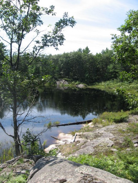
Roehl Wetland Reserve: This 71 acre property is typical of Shield landscape containing open rock barrens and a wetland creek which flows in the Severn River. It is home to eastern Massassauga Rattlesnakes, Five-lined skink, and various frogs and turtles. Reserve is located off Orimat Road, a private cottage road, but can be accessed by hiking 2km if gate is closed.
Helen M. Butler Reserve: Also located along the Orimat Road, the Butler Reserve is a 31 acre property set back from the Severn River and contains similar habitat as the Roehl Wetland Reserve.
Alexander Hope Smith Nature Reserve: Arranged in two phases, this Washago area reserve is now 219 acres. Eastern Hognose snakes have been found on the property making the Reserve crucial to the survival of this Species at Risk reptile. Hiking trails have been created by local volunteers. Access is on Riverdale Road, off Cooper’s Falls Road.
Ferry-Fawcett Natural Area is an 87 acre wetland just west of Washago, adjacent to the Trent Severn Waterway. Uncommon plants found there include sundew, pitcher plant, pink moccasin orchid, and skunk cabbage. Access to the property is along Anchor Drive/Agnew Road. There is a parking area at the end of Fawcett Drive near the waterway.