Konda & Gamroth Easement
Size: 44-acres (17.8-hectares)
Status: Not open to the public
Protected: July 19, 2000
Background:
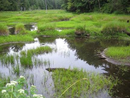
This easement is located in an area that has been identified as “The Land Between”. The Land Between is defined as a transition zone made up of a mosaic of patches and different edge habitats interspersed with wetlands, rock barrens, and pockets of grasslands. This region is a band of land that is identified by the Frontenac Arc to the east and the southeast corner of Georgian Bay to the west. This region contains northern species which are at the southern extent of the range of their habitat, while southern species are at the northern extent of their range.
This 19.4 hectare (48 acres) property is just outside the Southern Sand Plain Unit, identified in The Couchiching Conservancy’s Natural Heritage Action Plan (1994). This easement contains some land formations typical of the Muskoka region with gneissic outcropping and beaver controlled wetlands. However, the deep sandy deposits that are found throughout this property are not typical for the region.